Resources

Everyday Fire Risk Hiding in Your Portfolio
Non-weather fire. Why neighboring properties can have 30x different risk - and why most models miss it.
See how carriers are uncovering hidden fire risk.
Join us May 13 at 11a PT | 2p ET.
Reserve Your Spot
Learn what property-level intelligence reveals that community scores never could.
Non-weather fires cost the industry $25B in annual losses.
Claim severity is up 43%.
Yet most carriers are still assessing the risk with tools designed to measure how fast trucks arrive, not whether a fire starts.
Why Non-Weather Fire Is Difficult to Assess — and Easy to Miss
High severity, low visibility
At an average of $173K per claim, non-weather fire hits harder than any other peril. Yet most of the risk never shows up in loss history, leaving carriers exposed without knowing it.
How carriers are applying this in underwriting and pricing
How carriers are incorporating these signals into underwriting, pricing, and portfolio strategy — including a live look at Z-SPARK
A structural data gap
Much of this risk isn’t visible in claims data, and community-level scores treat neighboring properties as identical risks. They're not.
Portfolio impact
Bad risks enter quietly. By the time they surface, the loss in unrecoverable.
Featured Speakers
Alex Kallos
Risk Modeling & Analytics
Leads development of property-level risk models at ZestyAI
Abdul Mohammed
P&C Insurance Market Strategy
Leads product marketing for ZestyAI’s risk models, working with carriers on underwriting and pricing decisions

What You'll Take Away
How non-weather fire is evaluated today
Identifying the critical gaps in traditional assessment, where current tools fall short — and what they're missing
What’s driving severity and loss trends
What’s behind rising losses — and why claims are up 43% in four years. Why severity alone doesn't tell the story.
Where current models break down
How community-level scoring and incomplete data lead to misclassification, mispricing, and adverse selection
What actually differentiates risk at the property level
The signals that separate similar-looking properties — and where risk is often missed
Reserve Your Spot

Z-WATER™ Approved in Five More States as Non-Weather Water Losses Hit Record Severity
Utah, Colorado, Tennessee, Missouri, and Montana accept property-level AI model for underwriting and rating as interior water claims exceed $15B
Regulators in Utah, Colorado, Tennessee, Missouri, and Montana have accepted ZestyAI's AI-powered non-weather water risk model for use in carrier rate and rule filings, bringing the model's total approved footprint to 12 states nationwide.
Now the fourth-costliest peril in homeowners insurance, non-weather water drives more than $15 billion in annual losses across over 1 million claims, with average claim size exceeding $15,000. Routine failures like burst pipes and hidden leaks are now producing catastrophe-scale losses that surpass hurricanes in severity, yet the peril is difficult to model using traditional rating tools—which rely on territory-level or age-based proxies that overlook the property-specific factors driving interior water losses.
Using verified insurer loss data, Z-WATER™ applies computer vision to aerial imagery and incorporates property-level data, permitting history, localized climatology, and infrastructure context to capture the property-specific drivers of interior water losses. By modeling how these variables interact, Z-WATER predicts both the frequency and severity of non-weather water claims with 18× lift in risk segmentation compared to traditional territory- and age-based models.
"Non-weather water losses place real pressure on carriers' books, but they're also highly preventable when you understand where the risks actually lie," said Bryan Rehor, Director of Regulatory Strategy at ZestyAI.
"Z-WATER helps insurers pinpoint those vulnerabilities at the property level and price them appropriately, while meeting regulators' expectations for clarity and fairness."
These approvals add to ZestyAI's broader regulatory momentum. The ZestyAI platform — spanning wildfire, hail, wind, severe convective storm, non-weather water, and property and roof intelligence — has secured more than 200 regulatory approvals nationwide.
Carrier adoption and regulatory acceptance of AI rating models are accelerating in parallel, as the industry moves away from territory- and age-based proxies toward property-specific analytics.
.png)
Now Streaming: The Hidden Redesign of P&C Insurance
What 2 Million Filings Reveal About 2026 Product Strategy
P&C Insurance Is Being Rewritten - Quietly but Rapidly.
Filings from the last three years show faster shifts in P&C products than at any point in recent history - and those changes are now surfacing at scale.
Endorsements, exclusions, deductibles, and appetite resets are reshaping coverage and competitive positioning across carriers. But the pace isn't uniform. National carriers, regionals, MGAs, and farm bureaus are moving in different directions - and most teams don't have visibility into how quickly competitors are adjusting forms and filings.
This session breaks down the signals that matter for 2026 product strategy.
Drawing on 2M+ carrier filings, Stephanie Kuczynski reveals the real trends reshaping P&C product strategy headed into 2026.
You'll learn what's accelerating, where carriers diverge, and how to translate these shifts into action.
What You Will Gain
- Which changes are accelerating fastest — and where carriers diverge. State-by-state adoption patterns for endorsements, deductibles, and coverage restrictions.
- How strategies differ by carrier size and focus — niche players vs. nationals. The creative, targeted approaches emerging from regionals and MGAs versus the broad strategies deployed by national carriers.
- Where regulators are drawing the line on coverage restrictions. Prepare for closer state-level inspection, due diligence, and shifting expectations across markets.
- How these shifts impact 2026 product strategy and competitive positioning. Why the pace and direction of changes matter — and how to ensure your strategy reflects where the market is heading.
Watch Now
.webp)
Scott Stephenson joins ZestyAI's Board of Directors
Appointment comes as ZestyAI achieves cash flow positive growth, doubles product usage, launches Agentic AI platform, and adds 26 new carrier customers
A new chapter for risk intelligence
ZestyAI announced that Scott Stephenson, former Chairman, President, and CEO of Verisk Analytics, has joined its Board of Directors, bringing one of the principal architects of the insurance industry’s data modernization to the company at a pivotal moment for artificial intelligence in the industry.
Stephenson spent more than two decades at Verisk, including nine as Chairman, President, and CEO (2013–2022), where he helped transform the company into a global data and analytics leader. Under his leadership, Verisk more than quadrupled its market capitalization, became a component of the S&P 500 Index, and was repeatedly named one of the World’s Most Innovative Companies by Forbes.
Prior to Verisk, Stephenson was a Senior Partner at the Boston Consulting Group, where he advised Fortune 50 CEOs and founded the firm’s Southeastern U.S. practice. He currently serves on multiple public and nonprofit boards, including PSEG (NYSE) and Definitive Healthcare (NASDAQ).
Stephenson’s appointment comes as insurance moves beyond its data-driven modernization phase into a new stage where artificial intelligence is embedded across enterprise decision workflows.
“Insurance is one of the world’s most essential financial systems — a centuries-old institution that underpins economic growth and resilience,” said Attila Toth, Founder and CEO of ZestyAI. “Over the past two decades, data and actuarial science reshaped underwriting and risk management. Scott helped lead that transformation.
"Today, artificial intelligence is becoming the core decision infrastructure across the enterprise. His experience building durable, proprietary analytics platforms at a global scale is invaluable as we build the next generation of AI-powered risk intelligence.”
“This industry has endured for centuries because it adapts,” said Scott Stephenson. “The last major shift put data and analytics at the center of the enterprise. The next competitive frontier will belong to companies that build durable advantages from proprietary data and apply artificial intelligence to understand and manage risk with greater precision.
"ZestyAI is building exactly that kind of platform, pairing property intelligence with trustworthy AI to strengthen how insurers underwrite and manage portfolios. I look forward to working with the team as they scale this capability across the industry.”
A Year of Momentum and Scale
Stephenson joins ZestyAI at a moment of accelerating scale and operating leverage. In the past year ZestyAI has:
- Turned cash flow positive while more than doubling product usage across underwriting, rating, and reinsurance workflows
- Added 26 new clients, including Applied Underwriters, California Casualty, Lemonade, and Marsh
- Expanded commercial relationships with 12 existing enterprise customers through new agreements, including Berkshire Hathaway, the California FAIR Plan, and CSAA
- Surpassed 200 regulatory approvals nationwide, spanning multiple products and perils
- Introduced ZORRO Discover™, its agentic AI platform, embedding AI into enterprise workflows, including underwriting, portfolio management, and competitive intelligence
- Launched Z-SPARK™ which provides modern fire science and property-level intelligence to analyze how building materials, maintenance conditions, surrounding structures, local fire response capacity, and climate drive ignition and fire spread
Building on its continued leadership in wildfire risk analytics, in 2025 ZestyAI significantly expanded the adoption of its severe convective storm, wind, hail, and non-weather water suite of models, reinforcing ZestyAI’s evolution into a multi-peril decision intelligence platform.
That momentum is translating into measurable market impact. In 2025 alone, insurers using ZestyAI enabled coverage for nearly one million families and businesses previously considered difficult or uneconomical to insure, expanding access to coverage in catastrophe-exposed regions while maintaining underwriting discipline.
“ZestyAI has delivered what we look for in a market-defining company — disciplined execution, enterprise adoption, and profitable growth,” said Ben Cukier, Founder and Managing Partner at Centana Growth Partners and board member of ZestyAI.
“The company has expanded into a multi-peril AI platform embedded across underwriting, rating, and reinsurance workflows. Welcoming Scott Stephenson to the board at this stage reinforces both the scale of the opportunity and the strength of the foundation already in place.”
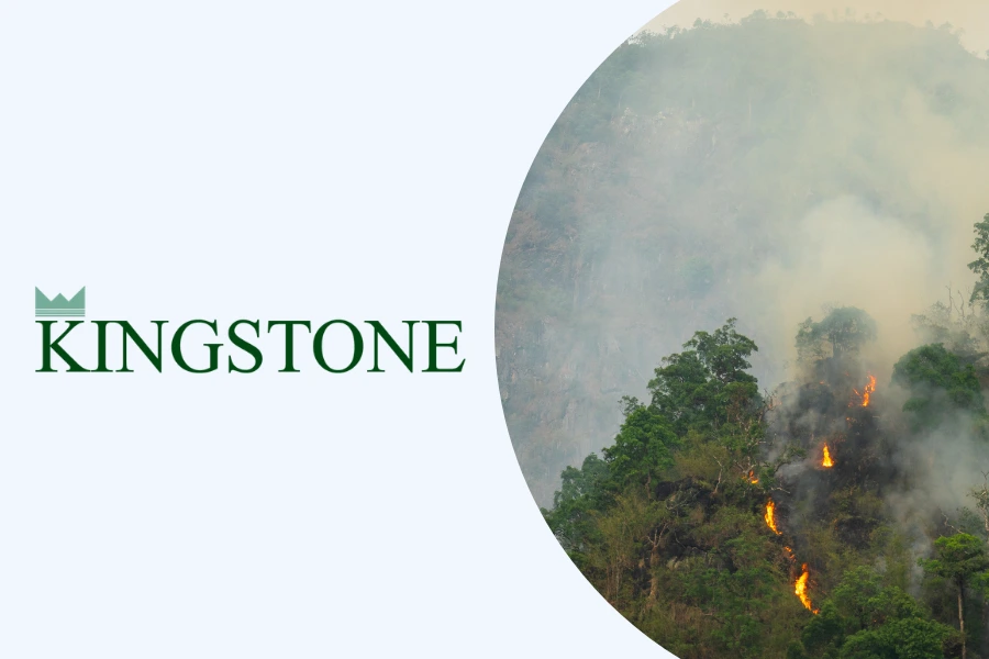
Kingstone Partners with ZestyAI to Strengthen Wildfire Risk Analytics for California Entry
The insurer will use ZestyAI’s AI-powered wildfire model to evaluate property-level risk as it enters the California homeowners market.
ZestyAI today announced a partnership with Kingstone Companies, Inc. (“Kingstone” to deploy property-level wildfire risk analytics as part of Kingstone’s planned expansion into the California homeowners market. As previously disclosed, Kingstone will enter California in Q2 2026 on an excess and surplus lines (E&S) basis, applying the same disciplined, data-driven underwriting approach that has driven record financial results in New York.
As part of its California rating and underwriting framework, Kingstone has integrated ZestyAI’s Z-FIRE wildfire risk model among the tools used to evaluate wildfire exposure at the individual-property level and to support disciplined underwriting in catastrophe-exposed regions.
Z-FIRE uses machine learning to evaluate each property’s unique characteristics, including defensible space, building materials, topography, and vegetation, to assess wildfire exposure at a granular level. This property-level insight enables Kingstone to differentiate risk within the same territory, improving rating and underwriting precision and portfolio oversight.
“Our California entry reflects the same disciplined, data-driven approach that has driven our results in New York,” said Sarah (Minlei) Chen, SVP, Chief Actuary and Head of Product Management.
“ZestyAI’s Z-FIRE model complements our Select platform by providing the property-level wildfire intelligence we need to rate and underwrite with precision in a complex and dynamic market like California.”
“Wildfire risk is pushing the insurance industry to embrace more advanced analytics and AI-driven decision making,” said Attila Toth, Founder and CEO of ZestyAI.
“With a clearer understanding of risk, insurers can make confident decisions about where they grow, how they manage exposure, and how they continue serving communities in wildfire-prone regions.”
Kingstone recently announced plans to enter the California homeowners market on an excess and surplus lines basis as part of its broader growth strategy. The move marks the insurer’s first geographic expansion outside the Northeast and reflects growing demand for insurance capacity in wildfire-exposed regions.
Z-FIRE is approved across all Western wildfire states and was the first AI-based wildfire model approved as part of a carrier rate filing in California. ZestyAI’s broader portfolio of AI risk models has secured more than 200 regulatory approvals nationwide.
Kingstone’s California strategy builds on the operational and underwriting transformation the Company has executed over the past four years. The Company’s E&S structure provides pricing flexibility to apply forward-looking wildfire models, set rates to achieve target margin requirements, and maintain strict underwriting standards including real-time accumulation management. Kingstone is maintaining a 30% quota share on its California business to manage net exposure during the initial scaling period.

Maryland and Nevada Greenlight ZestyAI's Severe Convective Storm Models as SCS Losses Top $50B
Approvals in Maryland and Nevada expand ZestyAI’s property-level risk models to 32 states nationwide.
ZestyAI today announced that the Departments of Insurance in Maryland and Nevada have reviewed and accepted ZestyAI’s Severe Convective Storm (SCS) risk models for use in carrier rate and rule filings, bringing the company’s SCS Suite to 32 approved states across the U.S.
Severe convective storms (SCS) have become one of the most persistent and costly sources of insured loss in the U.S., with annual losses exceeding $50 billion in each of the past three years. This trend has accelerated into 2026: in March alone, Gallagher Re reported multiple billion-dollar outbreaks impacting across several regions in the U.S.
“As loss patterns become more localized and volatile, traditional ZIP code-based models are no longer sufficient to capture the true drivers of risk,” said Bryan Rehor.
“These approvals reflect a shared commitment between regulators and carriers to more transparent, property-level models that clearly explain the ‘why’ behind a risk score and support more defensible rate-making.”
The approvals build on continued momentum across the ZestyAI platform, including the recent launch of Z-SPARK™, an AI-powered model that predicts non-weather fire risk at the individual property level. It evaluates the factors that influence ignition and fire spread to help insurers identify the structures most likely to generate costly fire losses.
ZestyAI’s SCS Suite is trained and validated on verified carrier claims data and delivers clear explanations of the factors behind each property’s risk score. By analyzing how local climatology interacts with individual property characteristics, the platform predicts the likelihood and severity of hail and wind claims with far greater precision than traditional territory- or ZIP code–based methods.
Key capabilities include:
- Z-HAIL: Quantifies hail risk using property-level drivers—roof geometry, accumulated damage, and local climatology—to pinpoint the buildings at greatest likelihood of hail damage, even within the same area.
- Z-WIND: Analyzes wind risk using AI-driven 3D analysis of roof condition, complexity, and potential failure points —together with localized wind climatology—to determine which buildings are most susceptible to wind damage.
- Z-STORM: Predicts the frequency and severity of storm damage claims, including hail and wind, examining the interaction between climatology and the unique characteristics of every structure and roof.
ZestyAI’s portfolio of AI-powered risk models has earned more than 200 regulatory approvals nationwide, reinforcing its continued expansion across key insurance markets as carriers adopt more precise, property-level approaches to managing weather and non-weather risk
Ready to see how ZestyAI works on your book of business?
Tell us a little about your needs. We'll show you how we reduce losses and help you price with precision.